Independence Day Sierra Ride - Highway 88, Markleeville, Ebbets Pass to Angels Camp
July 5th 2008 was a beautiful early summer day, and a fine time to take a ride up Highway 88, through Markleeville, over Ebbets pass, and down to Bear Valley and beyond.
The weather was perfect if a bit on the warm side as we prepared for departure. Temperature was about 90 degrees Fahrenheit in Pine Grove at about 9:30 AM, and it cooled rapidly as we gained altitude. Smoke from the recent California fires lingered at 2,400 feet elevation. Barely 40 minutes later, we were in cool and mostly clean air, almost completely devoid of the smoke that plagued the lower elevations over the last few weeks. Some haze remained but it didn't seem much worse than on other visits over the years.
Scenic Highway 88
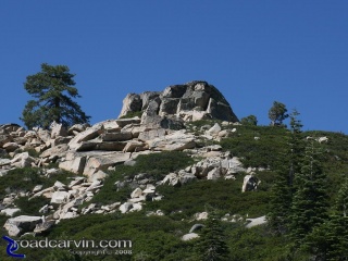
We stop at the scenic overlook just above Red Lake. There's a dramatic rock outcropping here that you must see to appreciate. There are trees clinging tenaciously to the rocks, defying gravity, surviving and even thriving against all odds.
It’s one of my favorite spots to shoot photos of the bikes, because you can get some great shots of the bikes with the rocks and trees in the background.
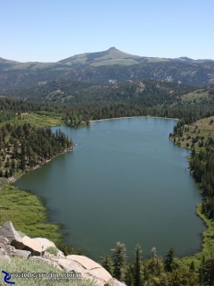
Red Lake: After you pass Caples Lake there is a scenic turnout on the steep downhill section that provides a great view of Red Lake.
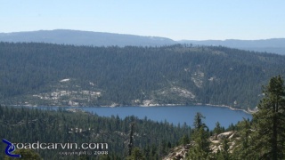
Bear River Reservoir: From a favorite scenic stop on the right side of Highway 88 East you can see Bear River Reservoir.
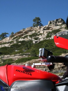
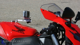
Scenic Overlook - CBR954RR: A shot of Dwight's Honda CBR954RR with the SportBikeCam mounted with a Canon S80 digital camera.
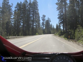
Just before Kirkwood Resort you ride though the Carson Spur, during the winter it's a serious avalanche area, during the summer it's a short section of nice curves.
Caples Lake
We continue on to Caples lake. A quick stop at Caples spillway reveals a parking lot filled to near capacity with cars bearing hikers and fishermen, and a few friendly dogs. We snap a few shots, scaring away a fisherman who was on the spillway footbridge.
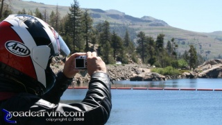
Caples Lake - Photo: I caught Dwight taking a photograph of Caples Lake with his Canon S80 with the SportBikeCam mount attached.
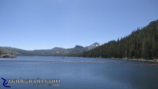
Caples Lake: Caples Lake is located just East of Kirkwood Resort. It's a great place to stop to stretch your legs and take in the scenery,
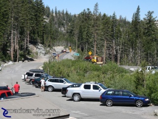
Caples Lake Parking: The parking lot at Caples Lake was full. People were enjoying fishing and hiking with their families or dogs.
Markleeville and the Wolf Creek Restaurant & Bar
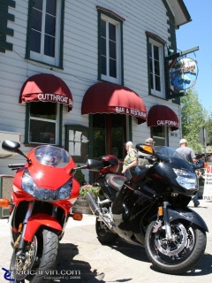
Wolf Creek Restaurant & Bar: We stopped in Markleeville for lunch at the Wolf Creek Restaurant and Bar. The food was satisfying and service was fast ,
We stopped for lunch at the Wolf Creek bar and restaurant; the meal was quick and satisfying; from what we could see it was a fairly popular stop for bikers. There were about 150 feet of bikes lined up on the street outside, we weren’t sure where all the riders were but at least some of them were inside Wolf Creek.
Riding out from Markleeville, the road surface quickly changed from smooth pavement to coarse slurry sealed surface and road construction signs directed us to ride at 25MPH. This section lasted about five miles, then returned to the normal decent-but-not-perfect-pavement where highway 89 East and highway 4 West meet.
We took highway 4 West heading into the tight and twisty sections of highway 4, leading to the Alpine overlooks, lakes and ponds. Road hazards included remarkably polite bicyclists and slower automobiles, which we were able to overtake without much trouble.
Dramatic Backdrop
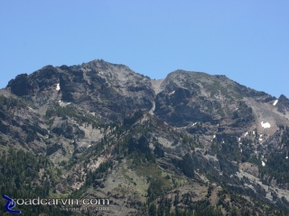
We stopped at a beautiful overlook with dramatic mountain cliffs in the distance – the overlook seemed to offer a great backdrop for motorcycle photography.
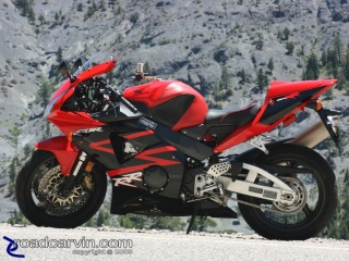
CBR954RR Cliffhanger: Cliffhanger, we were parked next to a steep drop off. I've taken many thousands of photographs of motorcycles and this is one of my favorites. Yeah, Dwight's biased, he loves riding his CBR954RR.
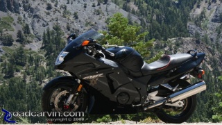
CBR1100XX Blackbird: The slate grey mountain provided a perfect backdrop to photograph my Honda Blackbird.
Mosquito Lake
Later, we stopped at the Pacific Grade Summit, at 8,050 foot elevation. There’s a beautiful lake here, bearing the somewhat unsettling name “Mosquito Lake”. We didn’t see many mosquitoes, but there were more than a few people here, fishing, boating, or just enjoying the scenery.
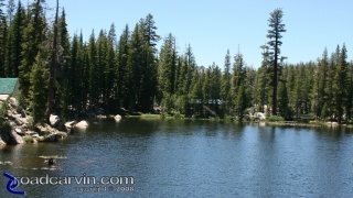
Mosquito Lake: Mosquito Lake is a great place to stop and take pictures. At an altitude of 7,882 feet you better be in shape if you want to hike around the lake
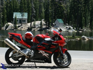
CBR954RR and Mosquito Lake Cabins: Two rustic cabins on Mosquito Lake make a nice backdrop for bike photos.
Hopping back on the bikes, and a short ride West on Highway 4, there are many more people on a larger section of the lake, lots more traffic, with serious parking congestion. Understandably so – it’s the Independence Day holiday weekend, and it’s really lovely here.
Dead Tree Overlook
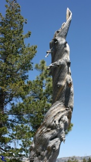
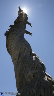
We motor past the crowds and head west. Dwight stops at another scenic overlook, this one in an unimproved parking area. This one is easy to miss, the entrance looks like nothing more than a low spot between two rock outcroppings.The overlook parking is peppered with large rocks and coarse sandy gravel is everywhere, waiting to spoil the day for the unwary motorcyclist. We do our best to pretend we are on bloated, overweight supermotard bikes and find a few reasonably level and stable spots on which to park our rides, and hop off to have a look around. There are some interesting outcroppings and trees, and a few picnic tables if you are inclined to stop for a snack.
Heading home
We’re almost out of the scenic area now, so there’s nothing more to stop and gawk at. The Bear Valley entrance is near, and we ride straight down to Murphys to stop for a quick gas refill and liquid refreshment. Highway 4 West is nice, but I find it a bit boring, as I prefer the sweeping vistas and variety of elevation when riding up Highway 88.
We ride back to the base camp via Railroad Flat Road and Highway 26 through West Point to Pine Grove. Cold beer awaits. In all, this has been a fine ride on a fine summer day.
Looking for more photos?
Check out our Sierra Ride photo gallery
Current Poll
Recent Comments
About the author
Author Name
Michael Curry
Author Bio
Michael has been riding street motorcycles since 1975. He's owned and ridden everything from Hondas to Harleys with a preference for spirited sport-touring riding.
Michael is a Roadcarvin.com co-founder and serves as chief editor, scribe, staff photographer, and other things.
